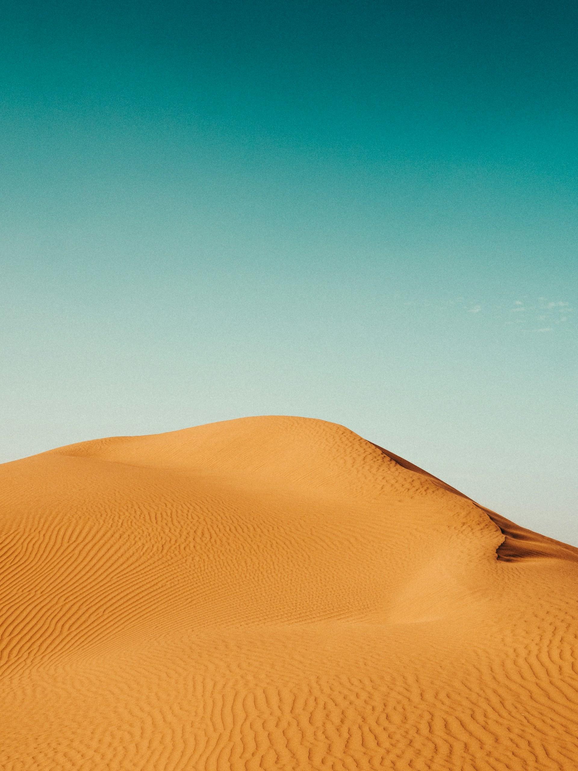
Deserts are natural systems that have low precipitation (rain), high evaporation rates, and unique processes that shape their landscapes.
In physical geography, systems concepts help understand these landscapes and how these systems maintain a dynamic equilibrium, constantly adjusting to changes through feedback mechanisms. Deserts are a challenging place for humans and many animal species.


Global Distribution of Deserts
Hot deserts are primarily found between 15° and 30° latitude, both north and south of the equator. These include the Sahara in Africa, the Arabian Desert in the Middle East, plus the deserts of Australia. Margins of these deserts often transition into semi-arid regions where some vegetation can survive.
What is a desert system? Well, in physical geography, systems concepts help understand these landscapes, considering inputs (such as solar energy and sediment), outputs (such as water and sediment removal), and energy flows.
Sources of energy that are present in the desert landscape are:
- Insolation: Direct solar radiation heats the desert surface, causing high temperatures and driving many desert processes.
- Winds: Winds are a significant source of energy, transporting sediment and shaping landforms through erosion and deposition.
- Runoff: Infrequent but intense rainfall events cause runoff, influencing the landscape through erosion and sediment transport.
Sediment Sources, Cells, and Budgets
Sediment in deserts comes from the weathering of rocks and soils, transported by wind and water. Sediment cells are areas where sediment is cycled between sources, stores, and sinks.
The sediment budget reflects the balance between sediment added to and removed from a system.
“Sediment budget refers to the balance between sediment added to and removed from the coastal system; in this respect the coastal sediment budget is like a bank account. When more material is added than is removed, there is a surplus of sediment and the shore builds seaward. On the other hand, when more material is removed than is added, there is a deficit in sediment supply and the shore retreats landward. Coastal erosion is a physical expression of a deficit in the sediment budget.”
US Geological Society
Geomorphological Processes
Geomorphological process that can also impact desert systems include:
- Weathering: Deserts experience thermal fracture (due to temperature changes), exfoliation (peeling of rock layers), chemical weathering (minimal but it is possible), and block and granular disintegration.
- Erosion: Wind and water erode desert surfaces. Wind causes deflation (removal of fine particles) and abrasion (wearing down of surfaces).
- Mass Movement: Gravity-driven movements like rockfalls are common.
- Transportation: Sediment moves via suspension (fine particles in the air), saltation (bouncing particles), and surface creep (rolling particles).
Distinctively Arid Geomorphological Processes
There are some specific processes that relate to arid locations (deserts):
- Wind Erosion: Deflation creates deflation hollows and desert pavements. Abrasion forms ventifacts (wind-shaped rocks) and yardangs (streamlined ridges).
- Transportation and Deposition: Wind moves the huge amounts of sand, forming dunes like barchans (crescent-shaped) and sief dunes (longitudinal).
Sources of Water
Sources of water are also harder to come by than many different locations and types of landscapes, but they do exist:
- Exogenous Rivers: Originate outside the desert and flow through it (e.g., the Nile).
- Endoreic Rivers: Flow into an inland basin or lake.
- Ephemeral Rivers: Flow intermittently after rain events.
Water's episodic role is crucial, causing sheet flooding and channel flash flooding that can reshape landscapes. While we don’t associate these areas with flooding all the time, it is a significant issue.
Landscape Development in Desert Areas
The main development of the landscape in the area can be categorised in a couple of different ways, and are either Aeolian or Fluvial in their nature. These are geographical concepts and we’ve given some examples below of what the areas and landscapes are actually called.
Aeolian Landforms:
- Deflation Hollows: Depressions created by wind removing loose sediment.
- Desert Pavements: Surface covered by closely packed stones.
- Ventifacts: Rocks shaped by wind-blown sand.
- Yardangs and Zeugen: Streamlined ridges and rock formations shaped by wind erosion.
- Barchans and Sief Dunes: Crescent-shaped and longitudinal sand dunes formed by wind deposition.
Fluvial Landforms:
- Wadis: Dry riverbeds that fill with water during rain events.
- Bahadas: Coalescing alluvial fans.
- Pediments: Gently sloping rock surfaces at the base of mountains.
- Playas: Dry lake beds.
- Inselbergs: Isolated rock hills or mountains.
Desertification
Over the last 10,000 years, the extent of hot deserts has changed due to natural climate variations and human activities. Desertification, the degradation of land in arid regions, is driven by climate change (altered precipitation patterns and increased temperatures) and human impacts such as deforestation.
Areas at risk of desertification face a number of complex issues like reduced vegetation, soil erosion, and increased dust storms, affecting ecosystems and human populations. Predicted climate change may make these issues even worse with potential severe impacts on local communities and issues with things like food security. Sustainable practices and policies are needed to mitigate these effects and ensure the resilience of affected areas.
Case Study: The Sahara Desert
The Sahara, the world's largest hot desert landscape, can provide a good example of the processes and landforms discussed. Its vast expanse features diverse landscapes from sand dunes to rocky plateaus.
Geomorphological processes at play include wind erosion. Dunes, such as the famous Erg Chebbi, result from wind action.
Deflation hollows and desert pavements are also common. Deflation hollows can even be kilometres wide, including the Qattara Depression in Egypt which goes down to 134 metres below the sea level.
Fluvial processes also happen. Although rare, intense rainfall can cause flash flooding in wadis, reshaping the terrain in the Sahara.
The Sahara's margins are expanding due to desertification. Human activities like overgrazing and deforestation, coupled with climate change, drive this process, impacting local populations and ecosystems.
Efforts to combat desertification in the Sahara include sustainable land management practices, reforestation projects, and policies aimed at reducing the anthropogenic impacts on the desert environment.
Conclusion
Hot desert systems and landscapes are delicately balanced, like so many other environments around the world. The deserts are shaped by unique processes and interactions between climate, geology, and human activity.
Understanding these processes helps to appreciate the dynamic and fragile nature of desert environments.
Revision Questions
What is a sediment budget?
A sediment budget is a balance sheet of the sources and losses of sediment within a particular section of the coastline or river system. It accounts for the quantity of sediment entering (sources) and leaving (sinks) a particular area, helping to understand the net gain or loss of sediment. This concept is crucial for coastal management, as it helps in predicting changes in shoreline position and in developing strategies for mitigating coastal erosion.
Why is the Sahara desert getting bigger?
The Sahara Desert is expanding due to a combination of natural and human factors:
Climate Change: Rising temperatures and changing precipitation patterns reduce vegetation cover, increasing desertification.
Overgrazing: Livestock overgrazing reduces plant cover, making the soil more susceptible to erosion and desertification.
Deforestation: Removal of trees for fuel and agriculture reduces the land's ability to retain moisture and increases the likelihood of desert conditions.
Unsustainable Farming Practices: Poor agricultural practices degrade the soil, leading to its eventual desertification.
What causes sand dunes to form?
Sand dunes form through the following processes:
Wind Erosion and Transport: Wind picks up loose sand particles from a source area, usually an arid or semi-arid environment with little vegetation.
Deposition: When the wind's energy decreases, it can no longer carry the sand particles, which then get deposited. Obstacles like rocks, vegetation, or even small topographical variations can cause wind speed to decrease, leading to deposition.
Accumulation: Over time, deposited sand accumulates and forms mounds or ridges known as dunes. The shape and size of dunes are influenced by wind direction, wind speed, the availability of sand, and the presence of vegetation.
Summarise with AI:
Did you like this article? Rate it!