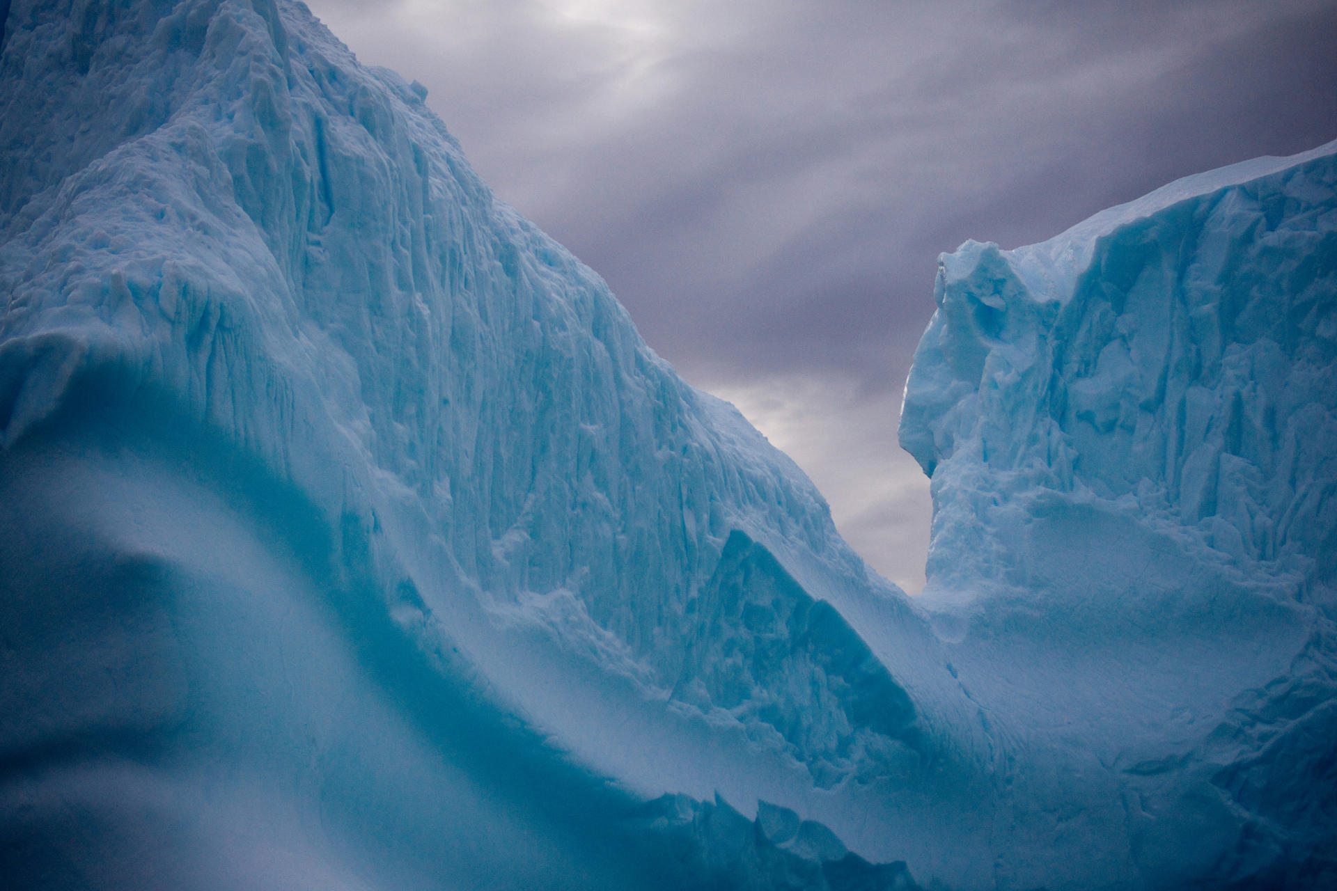
As a whole, the United Kingdom's landscape has been profoundly shaped by the immense forces of ice, especially during the last ice age.
Glaciers, towering masses of ice, slowly moved across the land, leaving behind many unique and fascinating landforms in their wake - those of which now fascinate both tourists and geologists alike. This article takes a close look into the glacial history of the UK, exploring how these icy giants, now a rare sight, once dominated the region.
But that’s not all we’ll talk about, we’ll also discuss related topics like the processes behind glacial formation, the specific landforms created by glaciers, and how these areas are managed and utilized today.
Whether you're studying for your GCSEs or simply fascinated by natural history, this comprehensive guide will provide lots of interesting insights into the icy forces that shaped the UK. Keep reading below.


How Did Ice Change the Physical Landscape of the UK?
During the last ice age, which took place over 18000 years ago, vast swathes of ice sheets covered much of the UK. Extending from the midlands (the middle of England) all the way to the tip of Scotland, these glaciers, moving under their weight, slowly transformed the landscape through a combination of weathering, erosion, transportation, and deposition
If you’ve read any of the other articles in this series, you’ll likely already be familiar with those terms, but if not, don’t worry, we’ll explain later on in the article.
All in all, the immense force exerted by this ice completely reshaped valleys, carved out basins, and left behind many varying and extremely distinct landforms. Online, you can find plenty of maps showing just how much of the UK was influenced by glaciation in the past, a far cry from today's decidedly less icy landscape.
How Are Weathering and Erosion Related to Glacial Landscapes?
Both weathering and erosion play a crucial role in the formation of glacial landscapes. When it comes to erosion, there are actually two types related to glaciation - abrasion and plucking.
The first of these, abrasion, only occurs when the glacier, weighed down by rock debris on its surface, starts to grind against the bedrock below it. After some time has passed, this grinding action actually leaves behind large grooves in the bedrock known as striations.
On the other hand, plucking, the other main type of glacial erosion, refers to when a glacier moves over bedrock and pulls large chunks of rocks away. Why does this happen? Well, the process is usually kick started when meltwater from the glacier seeps into cracks in the bedrock.
This process itself is called freeze thaw weathering, and is the most common type of weathering (the breaking down of rocks due to physical, chemical, or biological means) associated with glaciers. From here, the water eventually freezes and expands, thus causing the rock to fracture. As the glacier continues its slow advance, it then plucks these fractured pieces of rock and incorporates them into the glacier's base.
How Do Glaciers Transport and Deposit Material?
The mighty glaciers of the last age didn’t only change the UK’s landscapes through erosion, they also moved and deposited large amounts of material too. But how did this work? Let’s break the process down into several key stages:
Advancement and Bulldozing: Acting like giant bulldozers, glaciers slowly pushed large amounts of debris in front of them, eventually creating mounds of materials called terminal moraines which are made from everything from fine silt to large boulders.
Transportation within the ice: The glacier itself also contains a large amount of material. As the ice moves it carries rocks and other debris that has been plucked from the bedrock or fallen onto the glacier from nearby cliffs and embedded itself into the ice.
Deposition During Retreat: When glaciers melt and begin to retreat, they naturally leave behind much of the debris they were carrying. Often, this can create a variety of new landforms like lateral moraines (ridges of debris along the glaciers sides) and lateral moraines (formed where two glaciers meet).
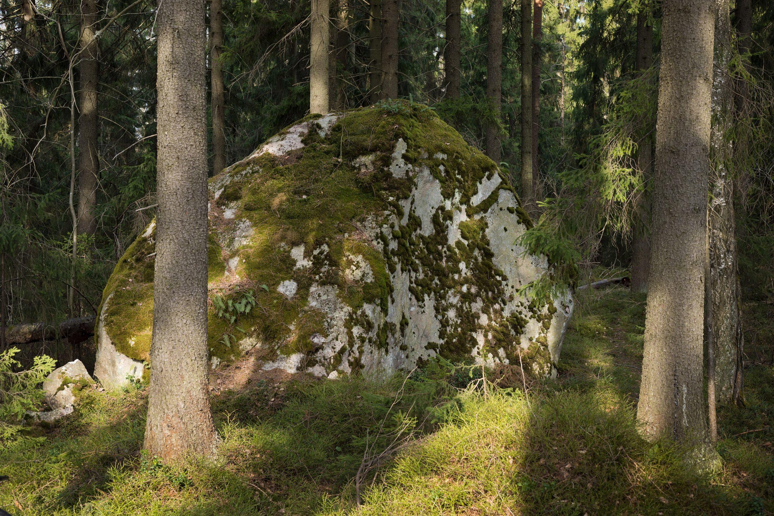
In areas once covered by glaciers, you'll find large boulders known as erratics. These seemingly out-of-place rocks tell a fascinating story of their long, icy journey across the landscape.
Lastly, drumlins are oval shaped hills that look like they were sculpted by the hand of a giant. They are streamlined in the direction of the glacier's flow, giving you clues about the glacier's path.
What Landforms Have Come About Due to Glacial Erosion?
Glacial erosion has given rise to some of the UK’s most striking and recognizable landforms, from dramatic mountain features to deep valleys and serene lakes. Let’s take a magnifying glass to some of the most remarkable of these:
Corries: These are bowl shaped depressions with steep back walls, often they are home to small lakes called tarns. Corries are created when snow begins to pile up in a mountain hollow and compresses into ice - forming a miniature glacier. Over time, the glacier erodes the hollow through abrasion and plucking, deepening and enlarging it to create a corrie.
Aretes: Types of sharp ridges that are formed by the erosion of two corries back towards each other. You can see this with your own eyes at famous locations like Striding Edge in the Lake District.
Pyramidal Peaks: These are pointed mountain tops which have been created by the erosion of several corries towards each other. This usually happens when three or more glaciers erode the sides of a mountain at the same time, thus creating a steep summit which kind of resembles a pyramid.
Truncated Spurs: As glaciers pushed through existing valleys, they sometimes encountered hills and ridges, gradually slicing through them as they went. As a result, this often left behind steep, cliff edges and gave the valley a unique V shape.
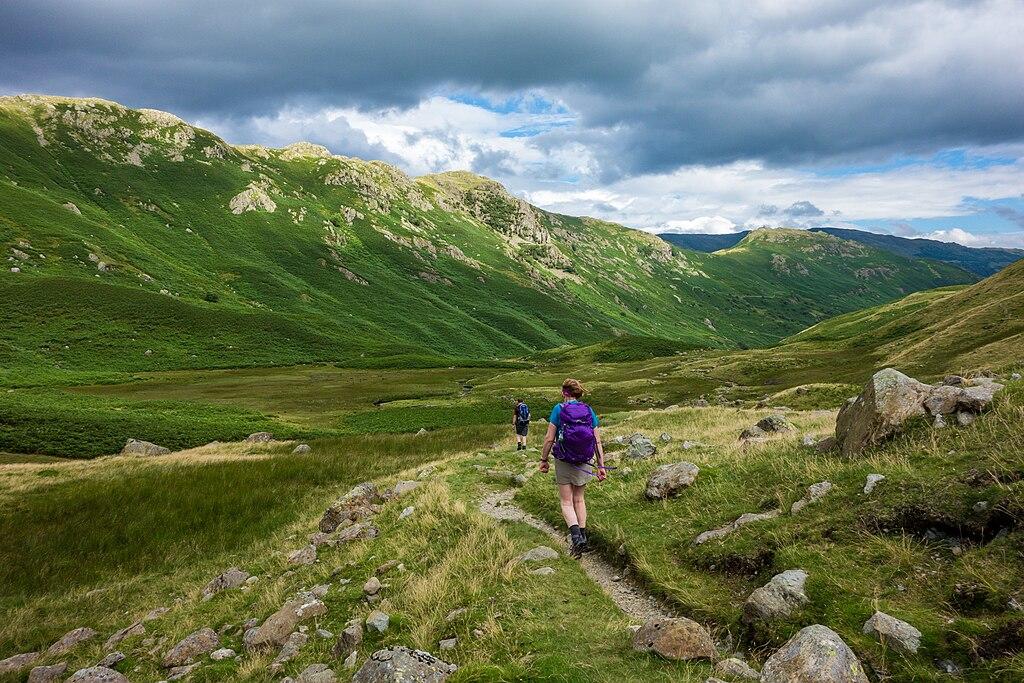
U Shaped Valleys: These valleys have a broad, flat bottom and steep sides and are created (you guessed it) when glaciers widen and deepen river valleys. One of the most famous U shaped valleys in the UK can be found at the Great Langdale Valley.
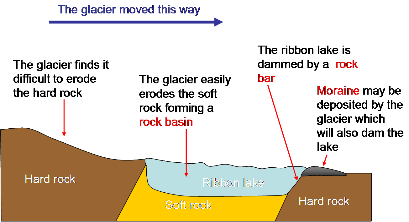
Ribbon Lakes: Ribbon lakes go hand in hand with u shaped valleys, being formed in the deep depression left in the valley floor by the glaciers. Over time, these hollows have filled with water, forming long and narrow lakes, such as Lake Windermere and Ullswater in the Lake District.
What Economic Activities Go on in Glaciated Upland Areas?
Although there aren’t many glaciated upland areas left in the UK, the ones that still exist, like the lake district, attract millions of visitors each and every year. The reason for this?
Most people come to see and photograph the breath taking landscapes first hand, while others come primarily to take part in various outdoor activities and enjoy the area's rich and fascinating cultural heritage
While the tourism boom does bring in a lot of money for the lake district year round, it also has negative effects such as overcrowding and environmental damage. Over time, the influx of tourists has resulted in many picturesque paths and trails becoming eroded, while former pristine areas have seen a decline in their natural beauty due to littering and pollution.
Farming, which mostly involves sheep and cattle grazing, thrives in these lush yet rugged landscapes as well. However, it’s not unusual for farmers to find themselves at odds with tourists. Hikers can unintentionally disturb livestock and damage crops, leading to a bit of friction between the two.
Forestry, although less prominent a feature, also plays its part by supplying timber and keeping forests healthy. This, too, sometimes bumps heads with conservation efforts aimed at preserving the natural beauty and habitats of the area.
Conclusion
In summary, the UK's landscape owes much of its unique character to glacial activity from the last ice age. Glaciers shaped valleys, carved out basins, and left behind striking landforms like corries, aretes, and U-shaped valleys. These glaciated regions are now hotspots for tourism, agriculture, and forestry, though managing the environmental impact remains a pretty big challenge.
Test Your Knowledge
What are glaciers and how have they shaped the UK landscape?
Please select a response.
Glaciers are massive bodies of ice that slowly move over land. Their movement over thousands of years has sculpted the UK's landscape, creating distinctive landforms through processes such as erosion and deposition.
During which period did glaciers cover much of the UK?
Please select a response.
The last ice age, occurring over 18,000 years ago, saw vast ice sheets cover much of the UK. This period was characterized by extensive glaciation that significantly altered the physical landscape.
Which processes are primarily involved in the formation of glacial landscapes?
Please select a response.
Glacial landscapes are formed through a combination of weathering (breaking down of rocks), erosion (wearing away of rocks by ice), transportation (movement of debris by glaciers), and deposition (laying down of material carried by glaciers).
What are the two main types of glacial erosion?
Please select a response.
Abrasion occurs when debris carried by glaciers grinds against the bedrock, leaving striations. Plucking happens when glaciers move over bedrock, causing rocks to freeze to the glacier and then be pulled away as the glacier moves.
Summarise with AI:
Did you like this article? Rate it!